
Alert
Per Executive Order 14172 and the Department of the Interior’s Secretarial Order 3423, the Gulf of Mexico has been renamed the Gulf of America. TTB’s AVA Map Explorer uses geographic information system (GIS) software that relies on base maps provided by the GIS software provider, which may not yet reflect this name.
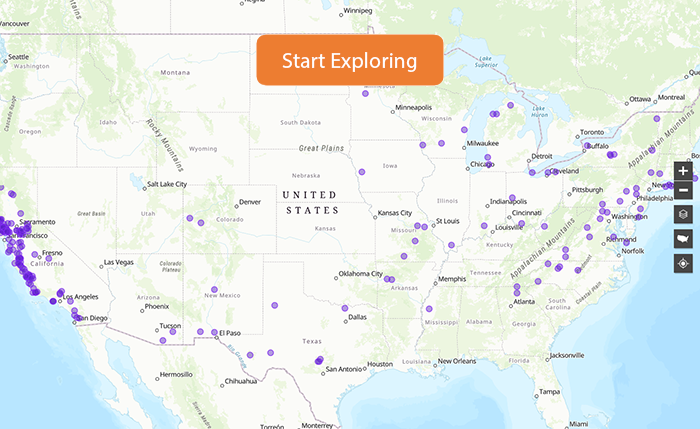
Use the American Viticultural Area (AVA) Map Explorer to view the boundaries of all established AVAs. You can also view the boundaries for any proposed AVA for which TTB has published a proposed rule document. (See the list here.) The Map Explorer has information about each AVA, including its state and county, when it was established, what other AVAs it contains or is within, and a link to its codified official boundary description. You can even plot an address on the Map Explorer to see if that location is within an AVA. You can also download "shapefiles" for the various AVAs, which you can use with geographic information system (GIS) software.
Please note that some features may not display correctly in Internet Explorer. For a better viewing experience, use an alternate browser such as Chrome or Firefox.
Looking for a complete shapefile for all of the established AVAs in the US, or for just the established AVAs in California, Oregon, or Washington? Contact us online using the Regulations and Rulings contact form.
Most Recent AVAs
| Columbia Hills; Conneaut Creek; Nashoba Valley; Nine Lakes of East Tennessee; Rancho Guejito | |
| Tryon Foothills |